Gravel Cycling To “Iniskim Umappi” - Majorville Medicine Wheel
The Majorville Medicine Wheel is an ancient stone circle located on crown land east of Milo, AB. Access to the site is via a rough gravel 2-track from the south. On this ride we started well east of the site and linked together a network of these 2-track roads to create a loop that we rode counter-clockwise (recommended).
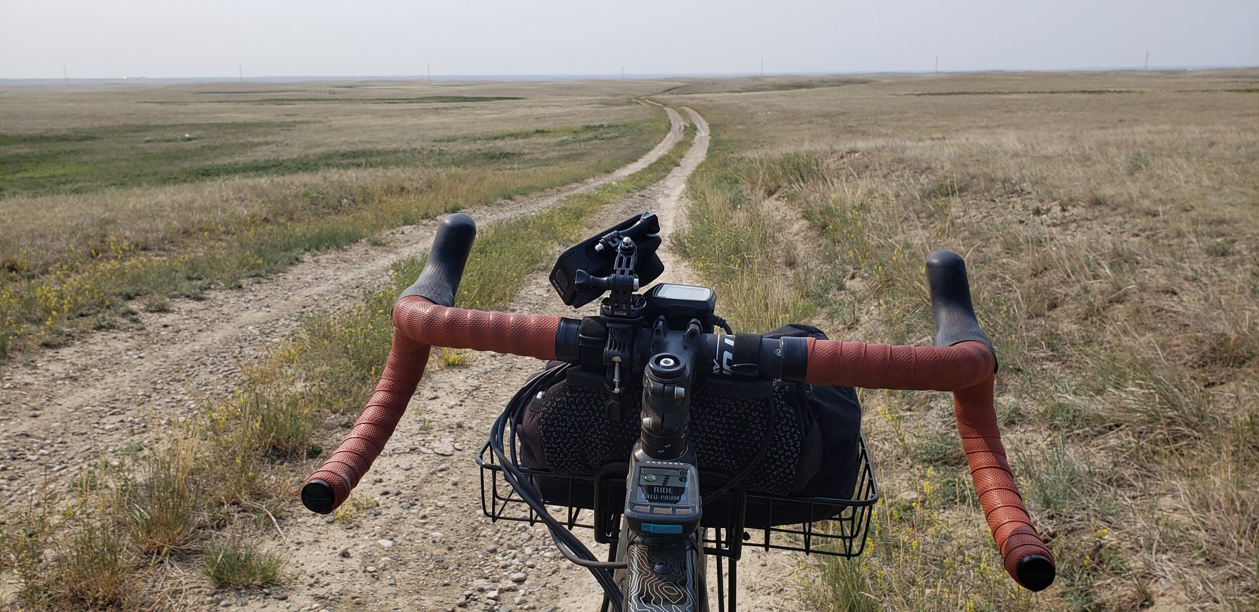
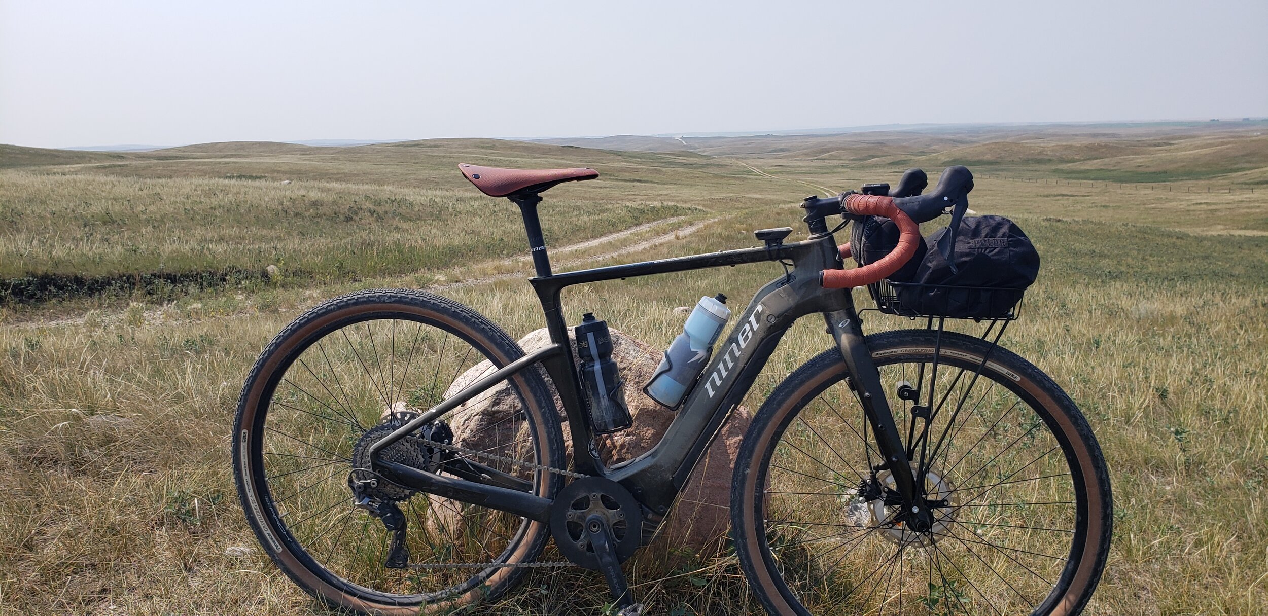
The route is totally rideable on a bike with 43mm+ tires but is quite rough in some sections as many of the 2-tracks used see very little use. I was on 50mm Panaracer Gravelkings and they were great. There is one segment from 3.7km to 7.8 that is overgrown so expect to be "weedwacking" through there - otherwise the route is generally pretty good. There are just a few steep ups, mostly we encountered gently rolling terrain, but we would recommend not coming out here if conditions were wet.
No water anywhere. No shade to be found. Just cows grazing, energy infrastructure here and there, and rolling treeless hills in every direction. Once past the weedwacking section things opened up quite a bit and some faster speeds were possible. Keep alert to washouts, sandy sections, and (dried) mud holes that appear sporadically.
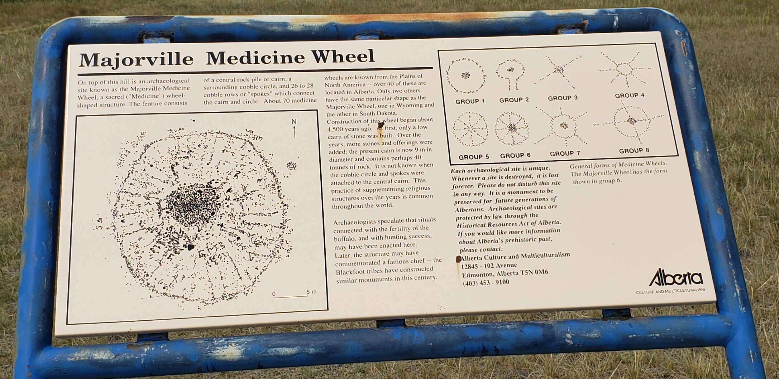
The whole ride felt eerie - in part because so much of the land appears to have never been disturbed by a farmers plow. This becomes especially true as you approach Iniskim Umappi - rocks are strewn across the land in a way you do not normally see anywhere else - offering an odd feeling that you were indeed riding back in time.
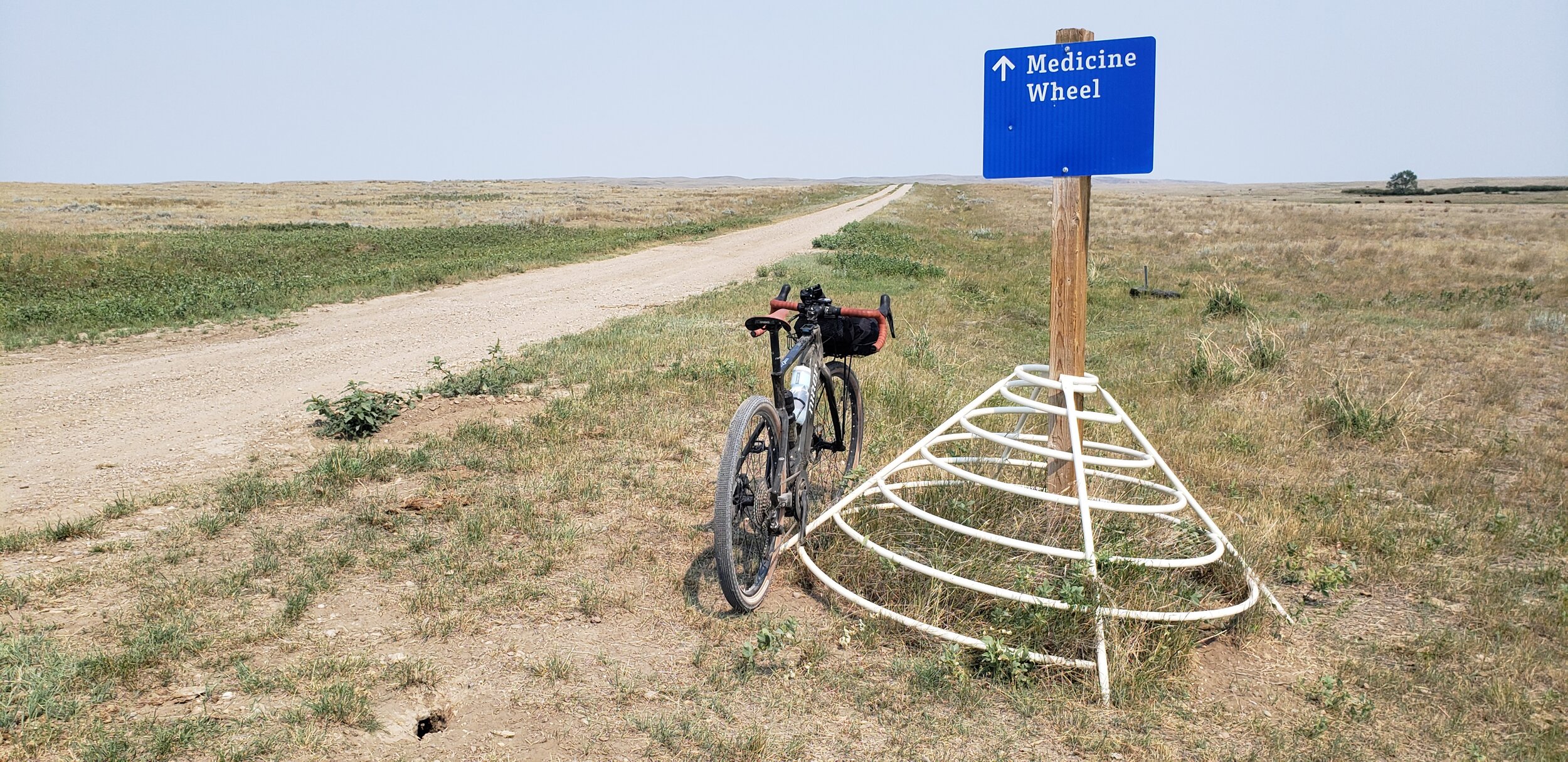
From the blue sign and up to the site itself the route is on fairly well worn gravel 2-track. Once at the site there is a parking area, information board (top of this article), and a short hike up a steep pitch to the stone circle. Take a few minutes to rest at the site, check out the 360 degree view as far as the eye can see, and tune into the power of this sacred space. Do not remove anything from the site and be respectful of this important place. Access to views of the Bow River are adjacent via 2-track.
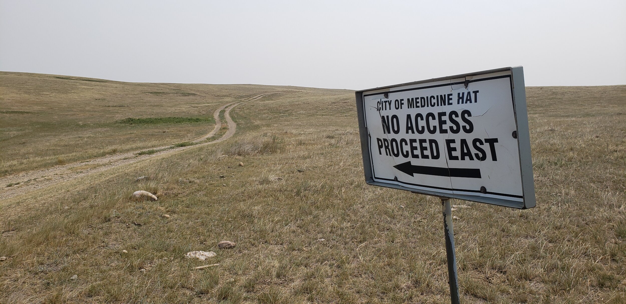
From this site, the route back is in generally fast and fun condition but there are a couple of sections of note. Km 36-39 does cross some private land - though there were no gates, just a sign and at Km 44 there is a paddock you need to cross. Ride through here at your own risk. Please securely close the gates behind you.
If you are thinking about going...
Ride this route at your own risk.
There is no specific parking available in the area and there is active oil/gas going on so do your best to find spot in the ditch/off the roadway. Do not block any driveways or access points.
An easier option is to park at Highway 539 and Range Road 183 and ride north 18kms one way to the site. Route info here.
You could park in Milo if you want a longer ride - that will add approx. 30 kms of mostly rolling, fairly deep gravel - ooof!
Make sure you have the GPS track and are comfortable navigating. Route info here. Plan for minimum 3-4 hours or more in the saddle. With every view in every direction looking identical it is easily to get confused about what direction you're going.
Some of the cattle guards on the route are dangerous, homemade contraptions - be careful at all of them.
Maybe most importantly, this route would likely be impassable if wet due to the clay content in the soil. Save adventuring here for a dry day.
Bring more water than you think you need. Also, there is no shade to be found anywhere.
The town of Milo has a very nice general store and there is a saloon at the historic hotel.